


As buckets of precipitation fell on Saline County and the Dorchester area this weekend, Mother Nature once again served us a reminder who is in charge.
According to an AP wire story, Turkey Creek was 5 feet over flood stage, forcing the closure of 20 county roads. Emergency Manager B.J. Fictum said flood watches and warnings remained in effect for Monday. The Dorchester, Wilber and Crete area recorded the state's heaviest precipitation amounts. Fictum said as much as 6 inches was reported in just a 24-hour period in Saline County. Some areas south of Dorchester reported as much as 7 inches over the weekend.
Below are photos from some of this weekend's historic rainfall. We welcome readers to submit their photos by e-mailing them to Dorchester.Times@gmail.com
In Town...
 Above, the town's main artery, Washington Street, looked like a Venetian canal. Below, 8th Street and cars parked on it were submerged. But the water did not deter the kids, who brought out inflatable rafts and mattresses. Meanwhile, the outskirts of towns were reminiscent of the Everglades.


In the Countryside...


Squaw Creek...

Above, that's the spillover from Squaw Creek, which looked more like the Big Blue River on Sunday. Below, the little creek that runs along Dorchester's southern edge could not be contained.


Turkey Creek...

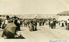
If Squaw Creek looked like the Big Blue River, Turkey Creek took on the form of the Platte. Below, Turkey Creek as it appeared Sunday at the Highway 15 bridge and the Creek's spillover near Pleasant Hill.


UNBELIEVABLE!
ReplyDeleteFantasitic shots you got here ...... I haven't seen turkey creek at that level of flooding in more than 10 years
ReplyDeletegreat pics
ReplyDelete