 An attempted assassination to take the life of a former U.S. president. The Democratic Party's ouster of a current president in exchange for a chameleon. A federal government spending so much your dollar's value is plummeting every second (it's called inflation).
Could it get any worse? Yes it could.
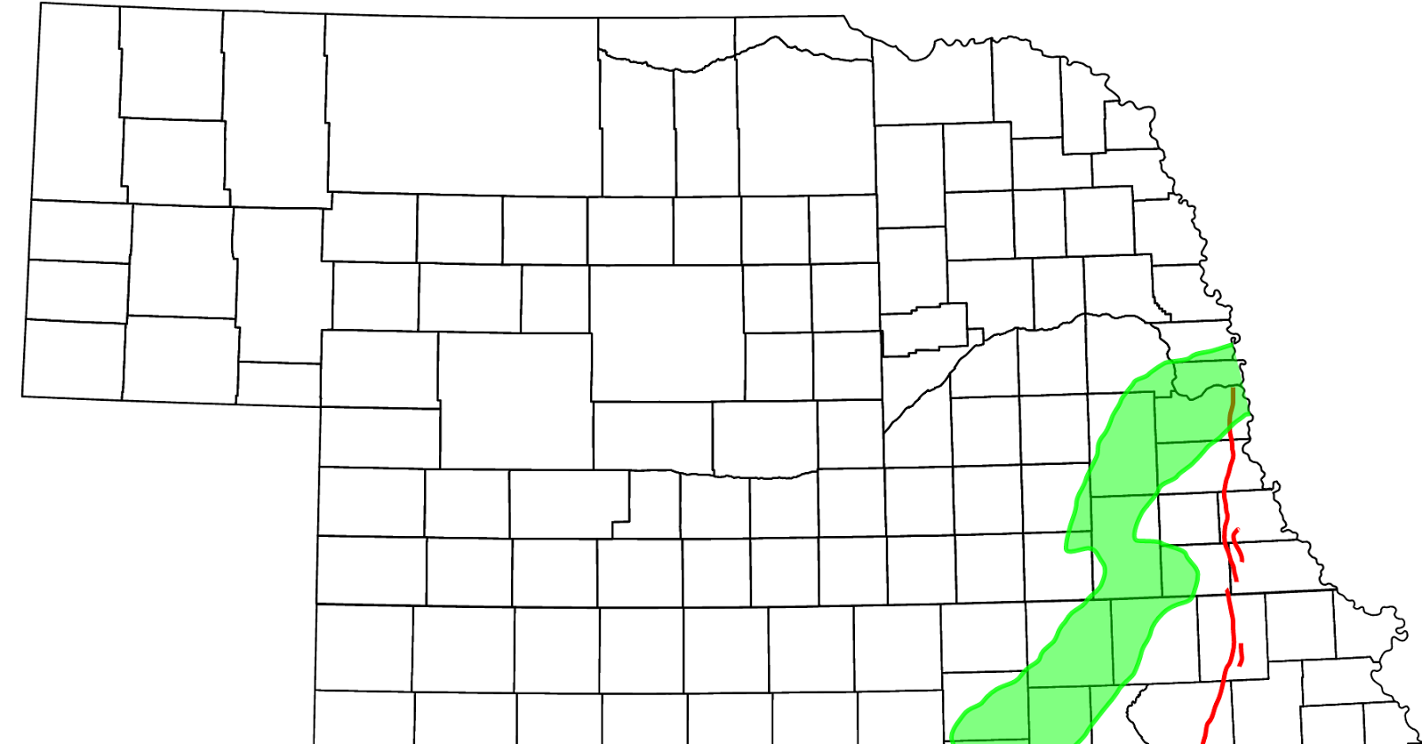
Southeast Nebraska lives under a minor threat of earthquakes. The Humboldt Fault Zone is a normal fault or series of faults that extends from Nebraska southwestwardly through most of Kansas -- all the way to Oklahoma City. The Humboldt line is close enough to the Saline County that we would certainly feel the impact of a major quake.
Most of the impact of a quake in southeastern Nebraska would likely do the most damage in southeast Nebraska up north to the Platte River area in Cass County, according to historical records.
Keep in mind that Nebraska (and Kansas, for that matter) is not particularly earthquake prone, ranking near the bottom of the 50 states by damage caused.

When it comes to potential for damage, northwest Nebraska claims the highest probability in our state.
But also remember this: The Humboldt Fault had the largest earthquake in Kansas history with the 1867 Manhattan, Kansas earthquake. It happened near the town of Wamego and was estimated at about 5.5 on the Richter scale. Reportedly it was felt as far away as Dubuque, Iowa.
Had Dorchester been around then, we're quite certain residents then would have felt it, too.
During the 1800's, Nebraska was the sight of some rather strong quakes, with one in 1811 in New Madrid, which registered an 8.1 and produced thousands of aftershocks. The earthquake was felt as far away as Washington, D.C. In strength, this quake superseded an 1877 quake, which is considered the largest quake on record and did serious damage in Lincoln and Omaha.
An article in "Nebraska Life" magazine reports that the New Madrid Fault Zone "is at greater risk of earthquakes that any location east of the Rocky Mountains."
There is speculation among experts that there is a connection between the Nebraska plates and others in the U.S. -- even in Alaska.
In March, 1964, there was a 9.2 quake in Prince William Sound, Alaska. This was the strongest earthquake ever recorded in the U.S., measuring 9.2 on the Richter scale. Merriman, Neb., on the same day, had four quakes, each about four minutes apart, which registered at 5.1 and impacted a 90,000 square mile area. This same scenario has occurred several times.
This information is being shared just as the super-volcano at Yellowstone National Park in Wyoming is showing signs of becoming active again. This is a much bigger threat to the survival of humans than asteroids, earthquakes, nuclear war, and certainly so-called "man-made global warming."
If the volcano at Yellowstone blows, who is in the White House won't matter.


No comments:
Post a Comment
Village Dweller checks all reader comments to determine if they are appropriate for print.